Dr Lis Gallant
Assistant Professor
Department of Geology
University of Hawaiʻi at Hilo
egallant@hawaii.edu
Research
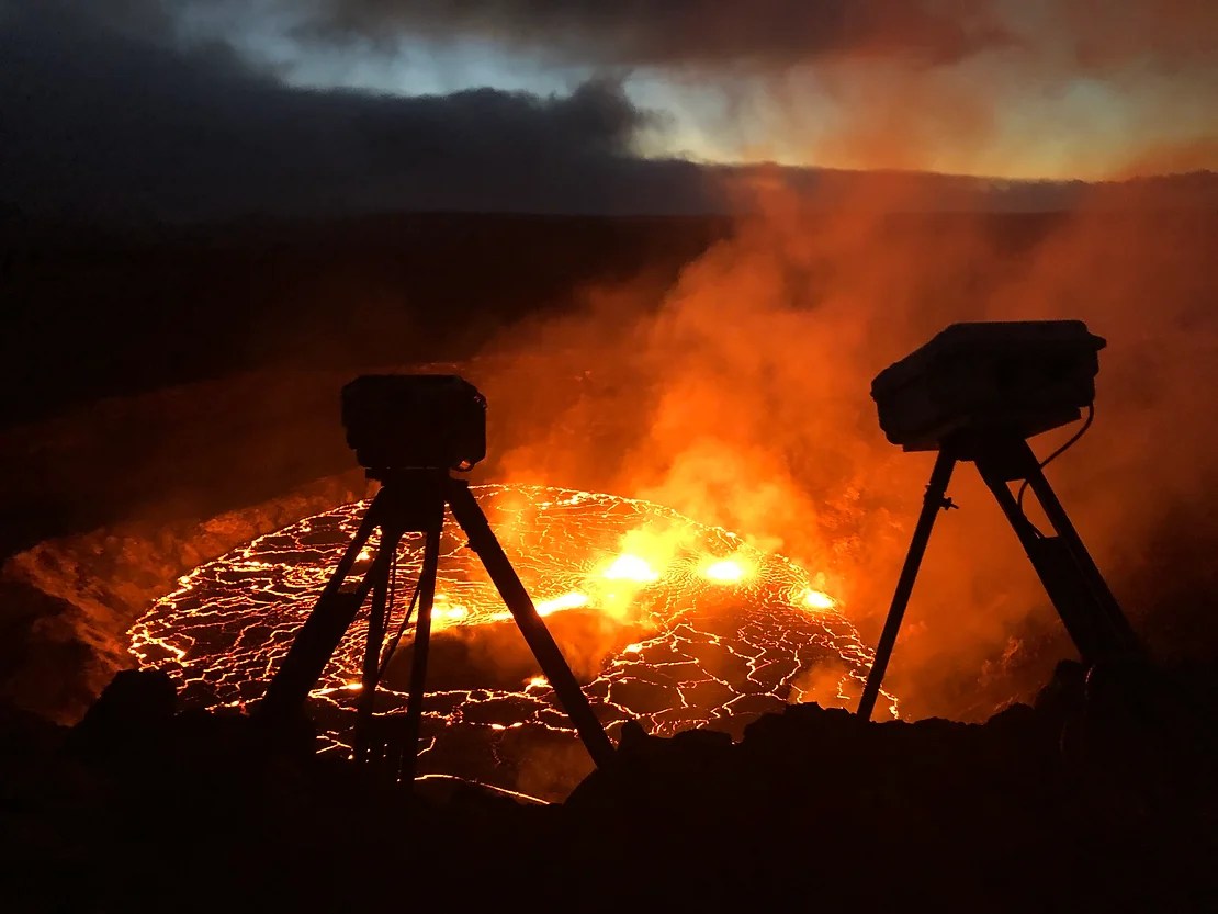
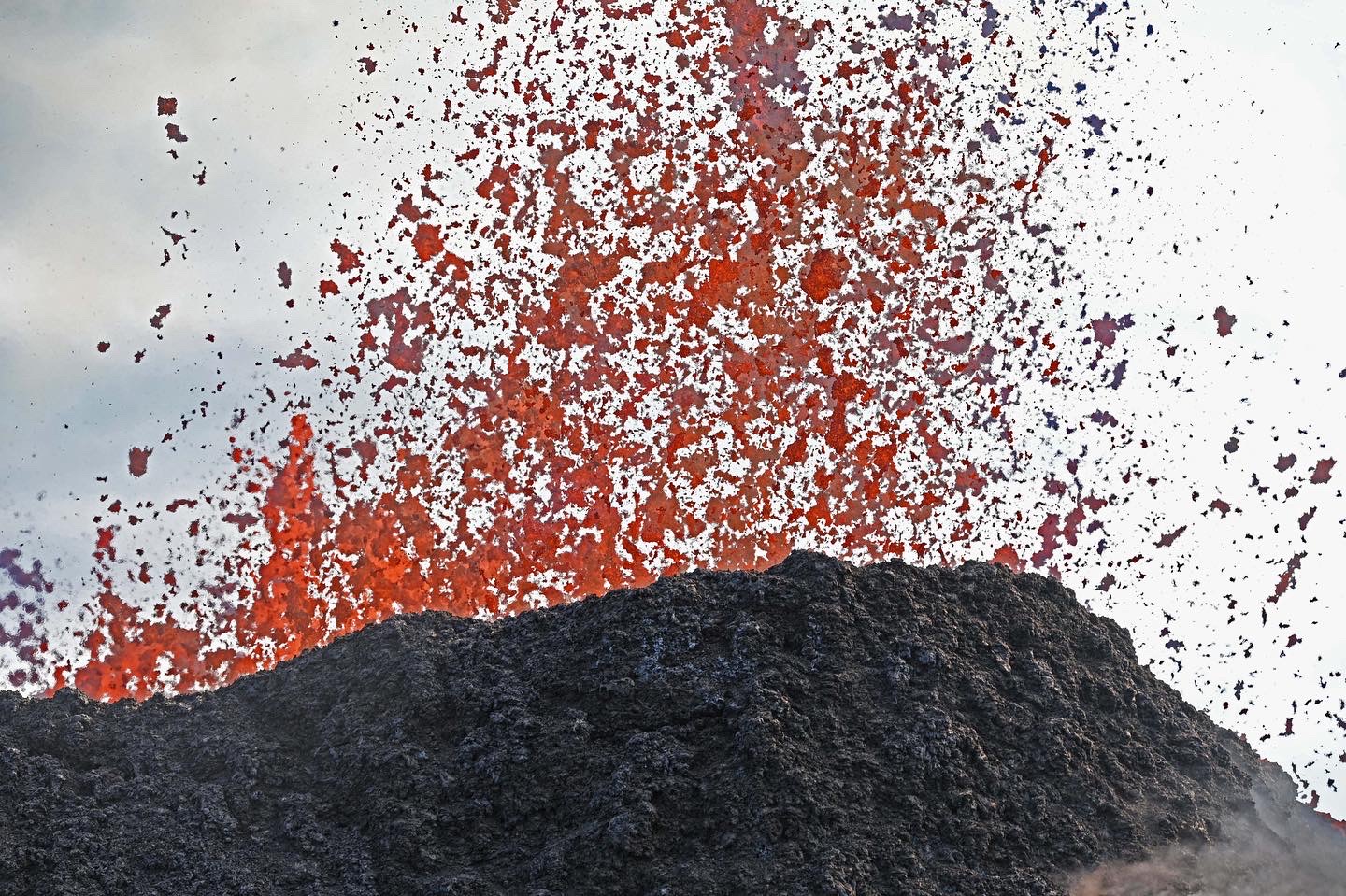
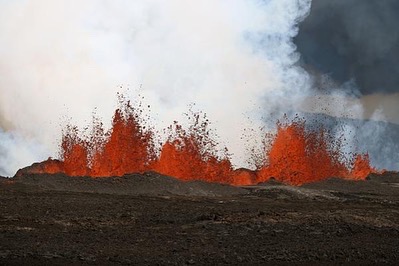
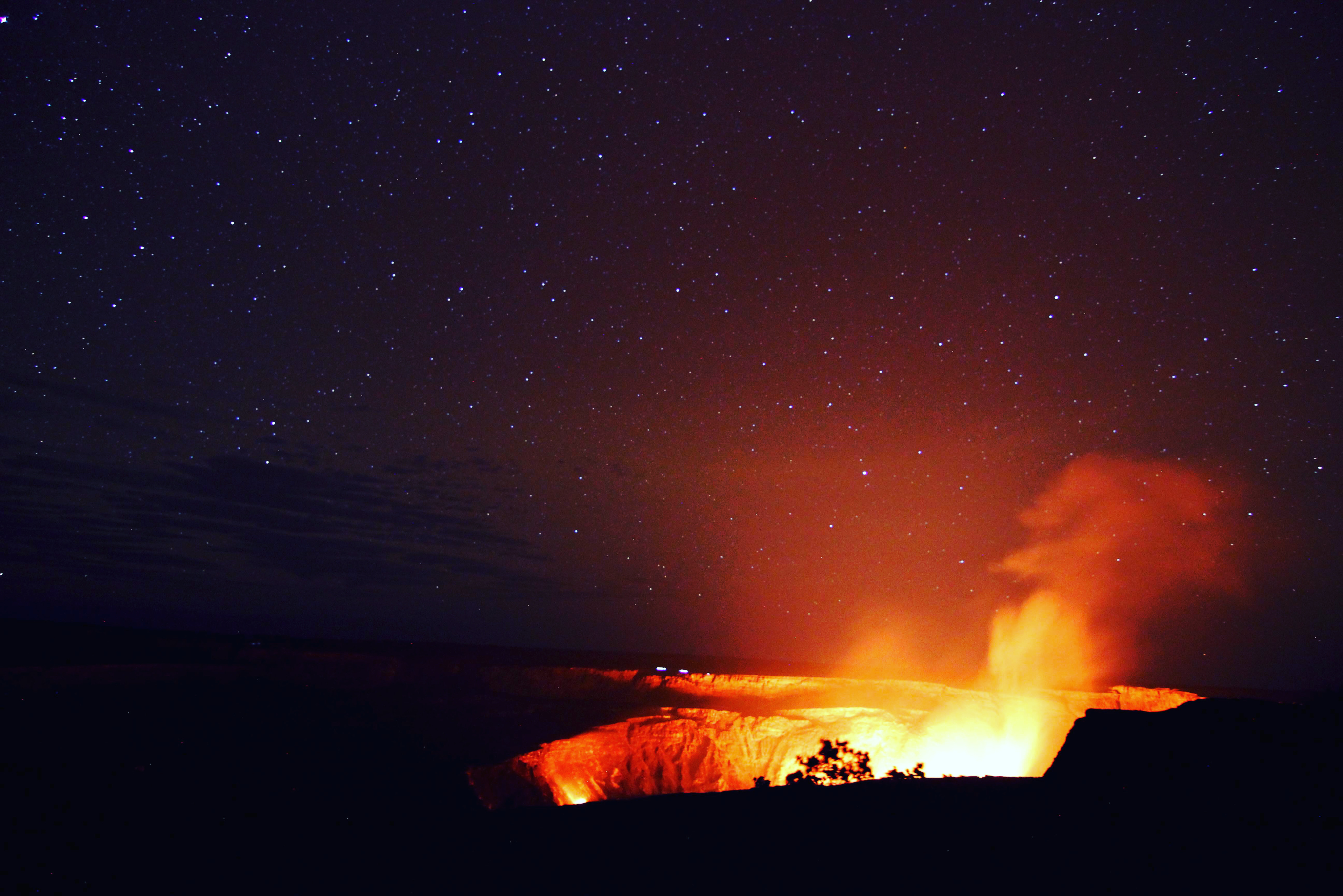
Eruption Response
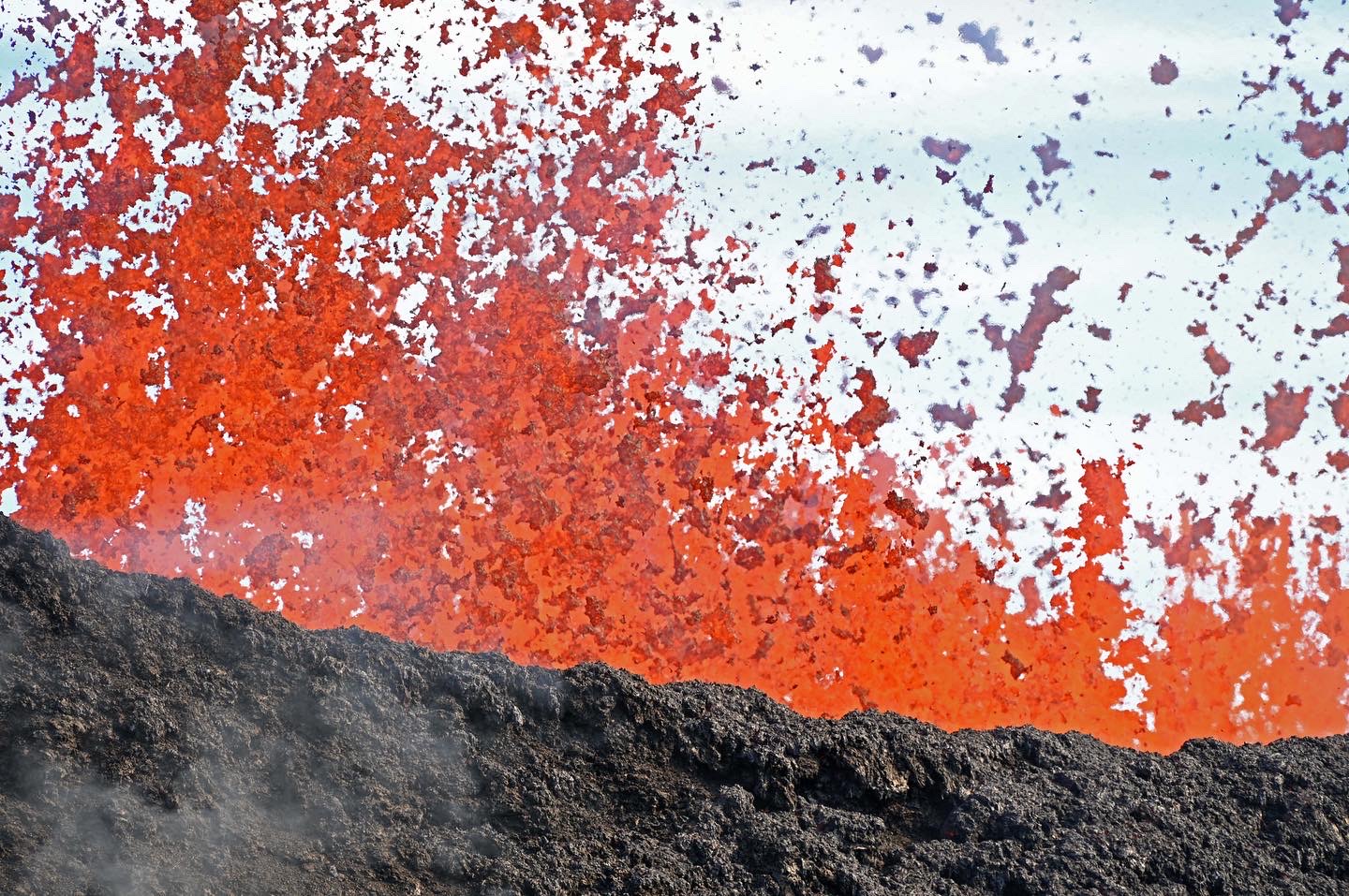
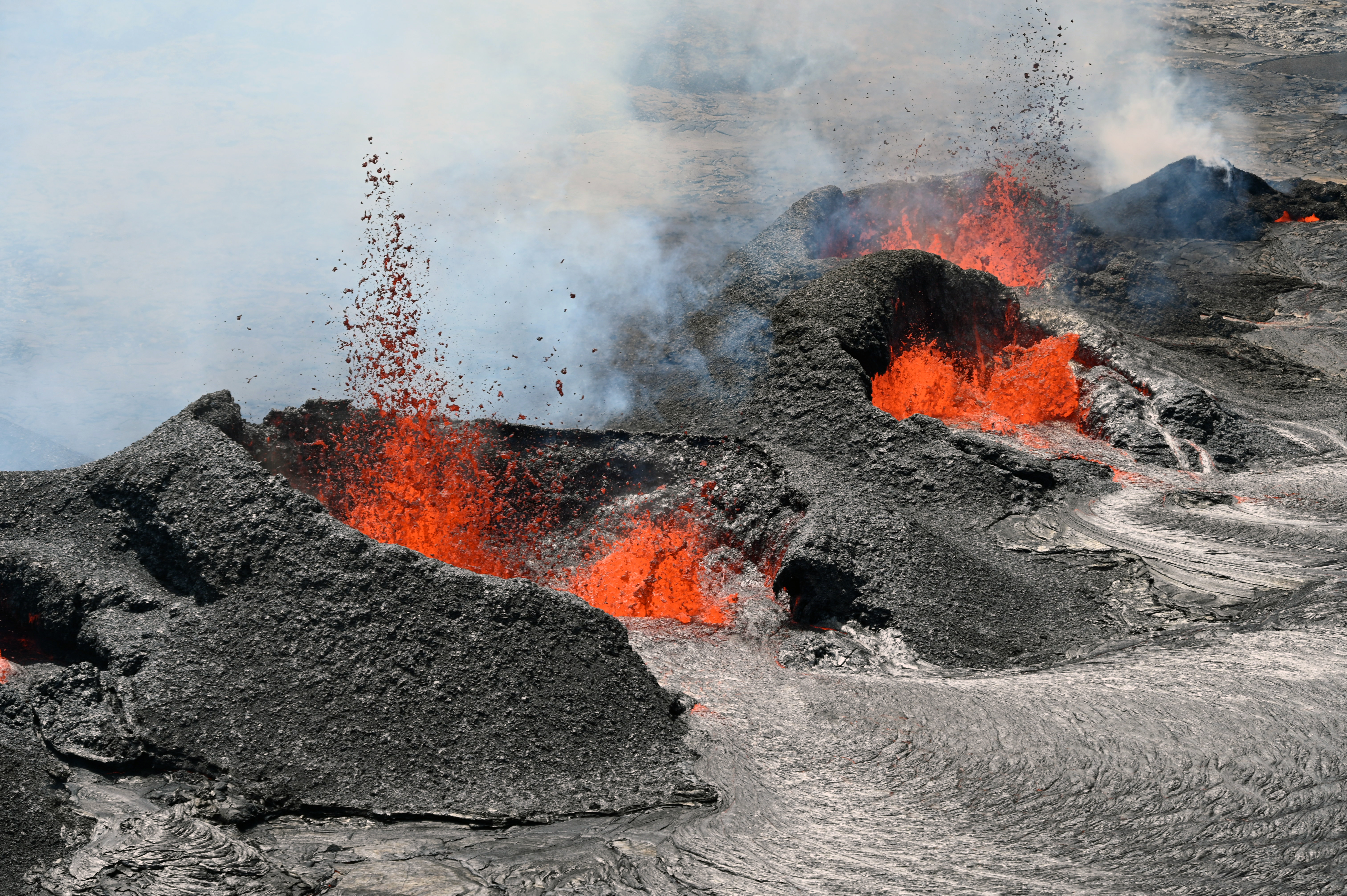
We partner with the Hawaiian Volcano Observatory to conduct same-day geochemical analysis of eruptive products from Kīlauea and Mauna Loa.
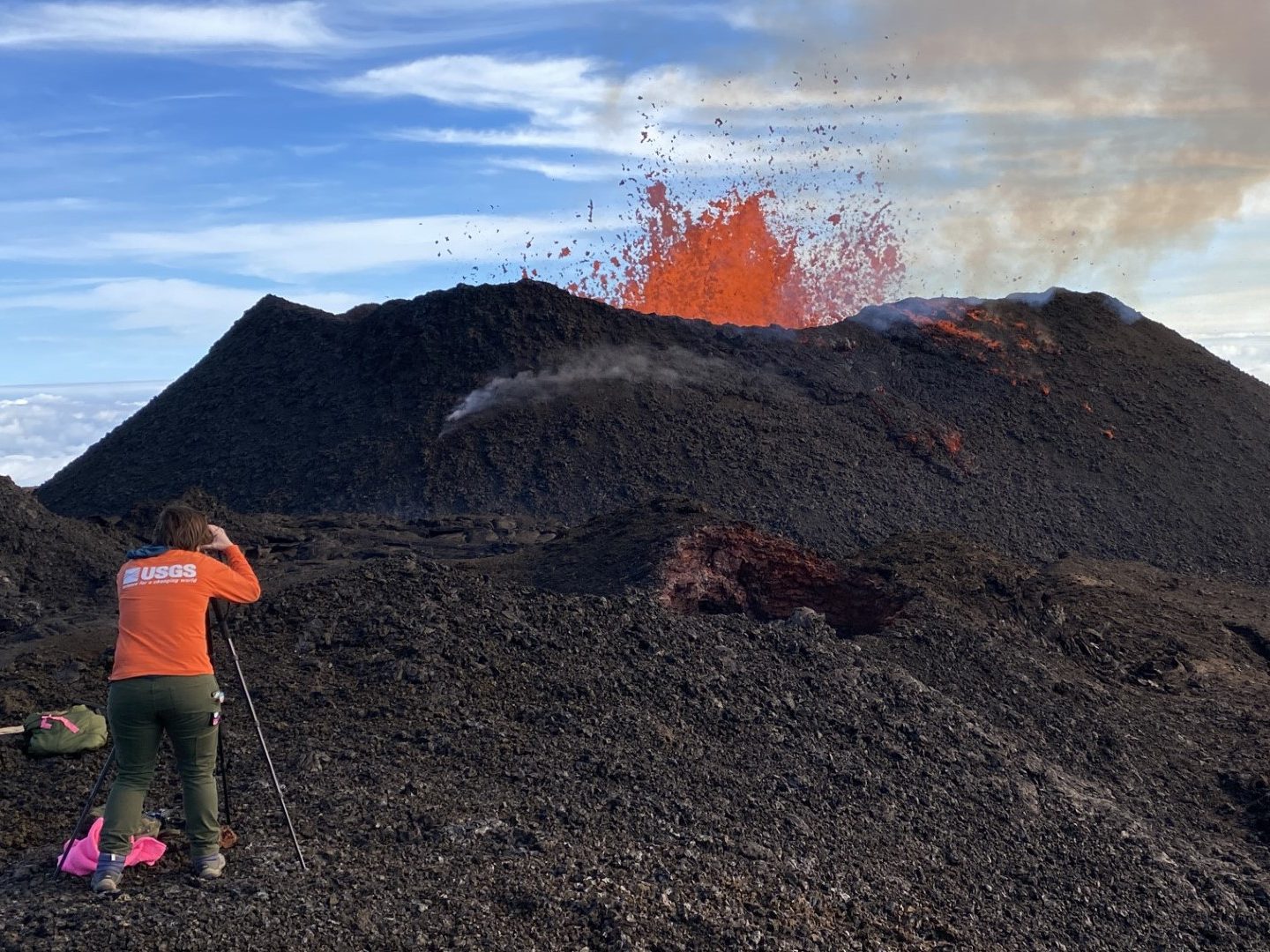
Edifice Growth
I am currently working on several projects that combine field observations and ground penetrating radar to study the growth of cinder cones.
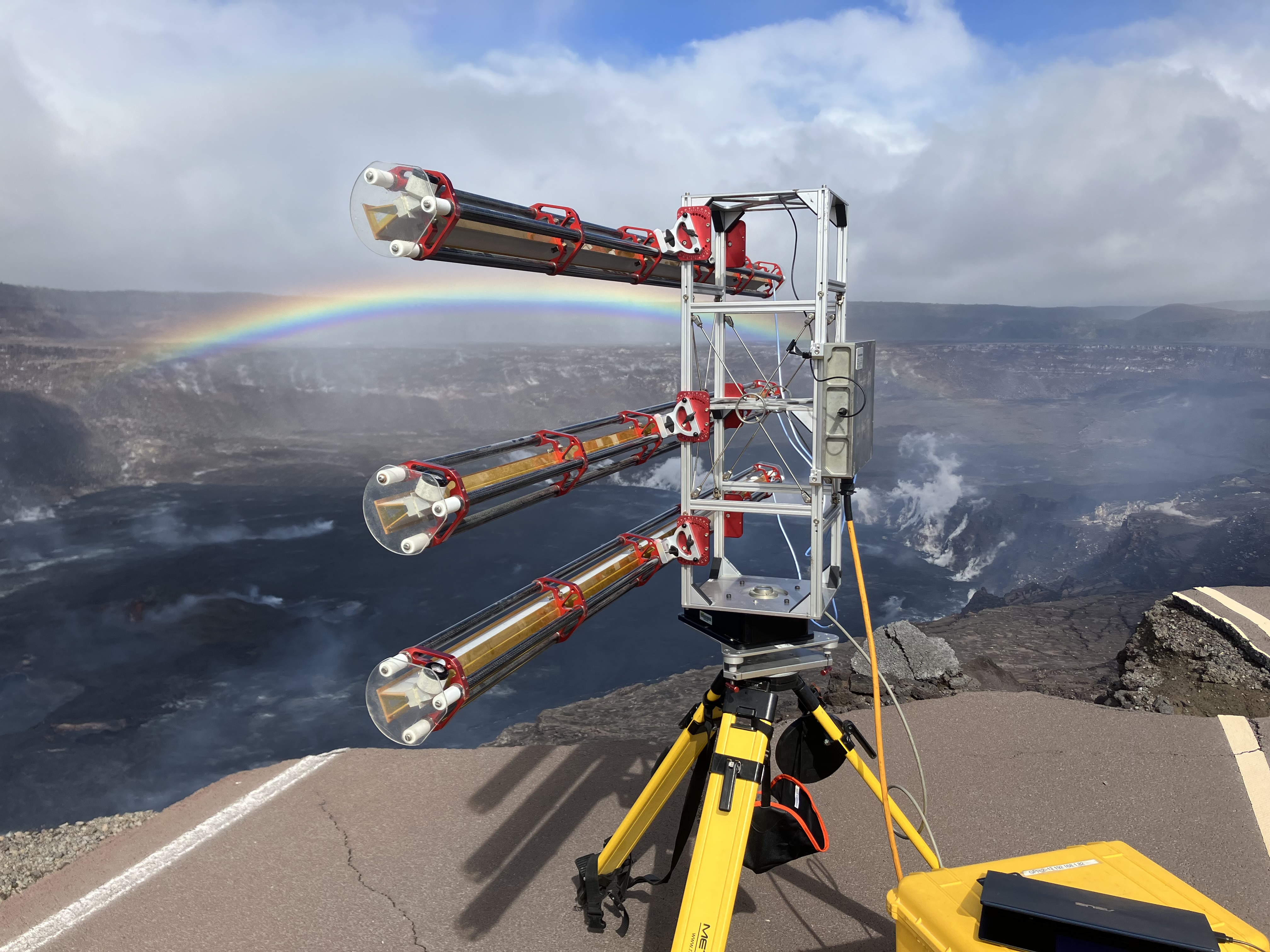
Lava Flow Behavior
Deploying novel instrumentation to quantify lava flow behavior is an ongoing area of interest. The ultimate goal is to provide improved data for use in modeling.
Note to potential students: The Geology Department at UH Hilo only admits undergraduate students. We participate in the National Student Exchange program and welcome undergraduate student visitors through that avenue every year. We are unable to admit graduate students but have helped support individuals as external committee members. We do not have funding to support non-UH Hilo researchers but are happy to work with interested postdoctoral scholars to craft grant applications.
Publications
- Dietterich, H.R., Patrick, M.P., Zoeller, M.H., Hyman, D.M.R., Trusdell, F.A., Gallant, E., Lynn, K.J., Mulliken, K., DeSmither, L., Parcheta, C., Lundgren, P. Lava flow emplacement dynamics during the Mauna Loa 2022 eruption. In prep for submission to Bull Volc.
- Gallant, E., Sadeghi Chorsi, T., Zoeller, M., Deligne, N.I., Hyman, D., Afra, M., Dixon, T.H., Operational application of ground-based radar interferometry for tracking lava flows: Example from the 2022 Mauna Loa eruption. In Review at Bull Volc.
- Lundblad, S., Mills, P., Lynn, K.J., Gallant, E., Gansecki, C., Near-Real-Time Geochemical Monitoring of Hawaiian Volcanoes using Energy Dispersive X-Ray Fluoresence. In Review at Bull Volc.
- Trusdell, F., Bennington, N., Downs, D., Chang, J., Dotray, P., Ellis, A., Nadeau, P., Patrick, M., Jolly, A., Lynn, K., Zoeller., M., Dietterich, N., Mulliken, K., Chang, J., DeSmither, L., Gallant, E., Schmidth, J., Gansecki, C., Orr, T., Parcheta, C., Walker, B., The 2022 eruption of Mauna Loa, Hawaiʻi: a synoptic and retrospective overview of the eruption. In Review at Bull Volc.
- Sadeghi Chorsi, T., Gallant, E., Forster, L.*, Dixon, J., D and Dixon, T., Small Intrusions Help Maintain Kīlauea’s Lava Lake. In Review at Bull Volc.
- Gallant, E., Dietterich, H., Patrick, M., Hyman, D., Carr, B., Lyons, J., and Meredith, E. (2025) Catastrophic lava flow levee failure: precursors, processes, and implications. Volcanica. [download]
- Hyman, D., Dietterich, H., Gallant, E., Lynn, K, Zoeller, M., Patrick, M., Kauahikaua, J., Trusdell, F., Hon, K., Denlinger, R., Foks, L., Lee, R.L., Falgout, J., and Gordon, J. (In Press). Real-time Lava Flow Forecasting during the 2022 Mauna Loa Eruption Response. Bulletin of Volcanology.
- Lynn, K.J., Gallant, E., Downs, D., and Trusdell, F., (In Press) Mauna Loa 2022 – Unrest, Eruption, and Outreach at the World’s Largest Volcano: preface to the special issue. Bulletin of Volcanology
- Lynn, K.J., Downs, D.T., Chang, J.M., Lundblad, S.P., Mills, P.R., McDade, B., Deligne, N.I., Gansecki, C.A., Schmith, J., Decker, M.F.I., Zoeller, M.H., Trusdell, F.A., Carr, B.B., Patrick, M.R., Parcheta, C., Nalesnik, A., Dietterich, H., Hazlett, R., Johnson, P.A., Gallant, E., Mulliken, K.M., Nadeau, P.A., Cappos, M.J., DeSmither, L., Peek, S., Damby, D., Dotray, P.J., van Helden, K.M., Shea, T., Hammer, J.E., Mourey, A.J., and Loewen, M., 2024, Sample details and near-real-time ED-XRF data collected during the 2020-2023 Halema‘uma‘u eruptions of Kīlauea volcano, Island of Hawaiʻi: U.S. Geological Survey data release. [download]
- Lundblad, S., Gallant, E., Zoeller, M., Lynn, K., and Flinders, A., (2024) Hawaiʻi Island Eruptions 2018-Present: Profound Landscape and Human Impacts. In Van Buer and Schwartz, eds., From Coastal Geomorphology to Magmatism: Guides to GSA Connects 2024 Field Trips in Southern California and Beyond: GSA Field Guide 70, p. 1-25. [download]
- Downs, D.T., Trusdell, F.A., Lynn, K.J., Schmith, J., Chang, J.M., Gansecki, C.A., Lundblad, S.P., Deligne, N.I., Orr, T.R., Gallant, E., Dotray, P.J., Zoeller, M.H., Patrick, M.R., Parcheta, C.E., McDade, B., and Mills, P.R., (2023), Sample details and near-real-time ED-XRF, grain size, and grain shape data collected during the November – December 2022 eruption of Mauna Loa volcano, Island of Hawaiʻi: U.S. Geological Survey data release. [download]
- Wetmore, P., Connor, C., Hastings, M., Mack, B., Gallant, E., Connor, L., Fallon, T., Nassir, R., and Malservisi, R., Gravity anomalies and alluvial fan areas of the Lost River Valley (Idaho, USA) and implications for basin architecture and the dip of the Lost River Fault.
- Marshall, A., Arroyo, Y., Gallant, E., Thatcher, S., Elardo, S., Williams, A., (2022) Flexible Fieldwork: Nature Earth and Environment. [download]
- Kavanagh, J., Annen, C., Burchard, S., Chalk, C., Gallant, E., Morin, J., Scarlett, J., and Williams, R., (2022) Volcanologists: Who are we and where are we going? Bulletin of Volcanology. [download]
- Gallant, E., Cole, L., Connor, C., Donovan, A., Molisee, D., Morin, J., Walshe, R., and Wetmore, P., (2021) Modeling eruptive event sources in distributed volcanic fields. Volcanica. [download]
- Ali, H., Sheffield, S., Bauer, J., Caballero-Gill, R., Gasparini, N., Libarkin, J., Gonzales, K., Willenbring, J., Amir-Lin, E., Cisneros, J., Desai, D., Erwin, M., Gallant, E., Gomez, K., Keisling, B., Mahon, R., Marín-Spiotta, E., Schneider, B., Welcome, L., (2021) A Twenty-Point Action Plan for Anti-Racism in 2020 Nature Communications. [download]
- Germa, A., Koebli, D., Wetmore, P., Arias, A., Savov, I., Diez, M., Greaves, V., and Gallant, E., (2020), Petrogenesis of the San Rafael subvolcanic field, UT: implication for the in-situ crystallization and segregation of syenite in shallow sills. Journal of Petrology. [download]
- Gallant, E., Deng, F., Connor, C., Saballos, J.A., Guitierrez, C., Myhre, D., Zayac, J., Richardson, J. Charbonnier, S., Thompson, G., Connor, L., Malservisi, R., LaFemina, P., and Dixon, T., (2020), Deep and rapid thermo-mechanical erosion by a small-volume lava flow. EPSL [download]
- Connor, C. B., Connor, L.J., Germa, A., Richardson, J.A., Bebbington, M., Gallant, E., and Saballos, J.A., (2019), How to estimate the probable locations of future volcanic vents using kernel density estimation, Statistics in Volcanology 4. [download]
- Deng, F.,Rodgers, M., Xie, S., Dixon, T., Charbonnier, S., Gallant, E., López-Velez, C., Ordoñez, M., Malservisi, R., Voss, N, Richardson, J., (2019), High-resolution DEM generation from multiple remote sensing data sources for improved volcano hazard assessment – a case study at Nevado del Ruiz, Colombia: Remote Sensing of Environment, vol. 233. [download]
- Xie, S., Gallant, E., Wetmore, P., Owen, L., Figueiredo, P., Malservisi, R., and Dixon, T., (2019), A new geological slip rate estimate for the Calico Fault, eastern California: Implications for geodetic versus geologic rate estimates in the Eastern California Shear Zone: International Geology Review. vol. 61:13, p. 1613-1641. [download]
- Gallant, E., Richardson, J., Connor, C., Wetmore, P., and Connor, L., (2018), A new approach to probabilistic lava flow hazard assessments, applied to the Idaho National Laboratory, eastern Snake River Plain, Idaho, USA: Geology, vol. 46:10, p. 895-898. [download]
- Richardson, J.A., Connor, C., Wetmore, P.H., Connor, L., and Gallant, E., (2015), Role of sills in the development of volcanic fields: Insights from lidar mapping surveys of the San Rafael Swell, Utah: Geology, vol. 43:11, p. 1023-1026. [download]
- George, O., McIlrath, J., Farrell, A., Gallant, E., Tavarez, S., Marshall, A., McNiff, C., Njoroge, M., Wilson, J., Connor, C., Connor, L., and Kruse, S. (2015), High-Resolution Ground-Based Magnetic Survey of a Buried Volcano Anomaly B, Amargosa Desert, NV: Statistics in Volcanology, vol. 1, p. 1-23. [download]
Teaching
Courses at UH Hilo
- Introduction to Geology (GEOL 111)
- Introduction to Geology Laboratory (GEOL 111L)
- Volcanoes and Earthquakes (GEOL 170)
- Introductory Field Experience (GEOL 195)
- Geology of the Hawaiian Islands (GEOL 205)
- Earth Materials I: Mineralogy (GEOL 212)
- Earth Materials II: Petrology (GEOL 320)
- Directed Research (GEOL 399)
- Geologic Remote Sensing (GEOL 420)
- Volcanology (GEOL 470)
- Volcano Monitoring (GEOL 471)
Courses at other Universities
- GeoSPACE (University of Florida)
- Physical Geography (University of Cambridge)
- Structural Geology (University of South Florida)
- History of Life (University of South Florida)
- Field Camp (University of South Florida)
- Introduction to Digital Imaging (Rensselaer Polytechnic Institute)